Mapping and Field-Level Accurate Data Acquisition using Handheld High-Precision LOKUS GNSS Receivers
Mapping and field-level accurate data acquisition for updating the maps is an essential tool in survey which is now possible using LOKUS GNSS receivers.
Read More
Disruption in Geo-Tagging and Mapping operations using palm sized high precision LOKUS GNSS
Geo-tagging of field assets and updating the maps of India is being carried out by the Survey of India, and all the GDCs of all the states entrusted to achieve this.
Read More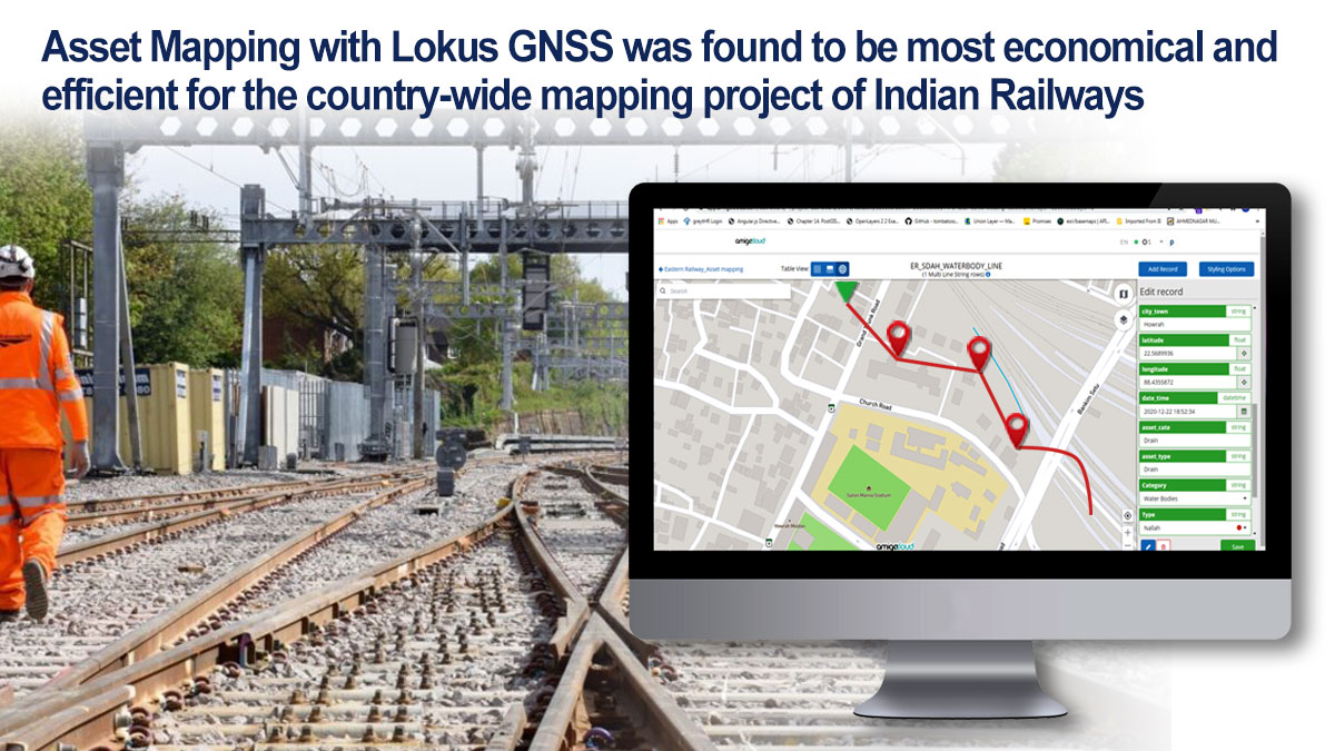
Mapping of Railways lines and assets with Lokus GNSS
Asset Mapping with Lokus GNSS was found to be most economical and efficient for the country-wide mapping project of Indian Railways.
Read More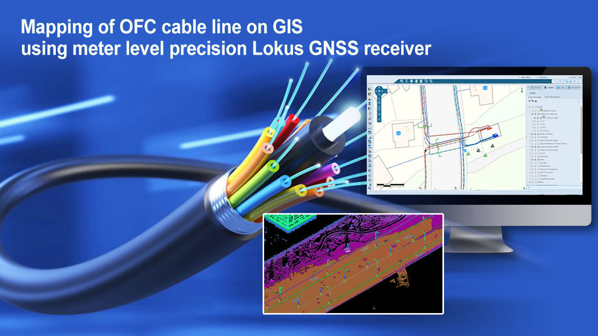
Mapping of OFC cable line on GIS using meter level precision Lokus GNSS Receiver
Government of India has taken up a project called BHARATNET, the world’s largest rural broadband project to provide broadband connectivity to all of the 2.5 lakhs villages across India.
Read More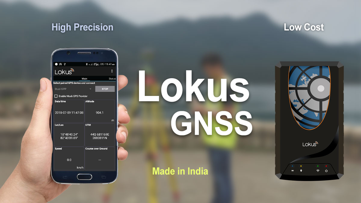
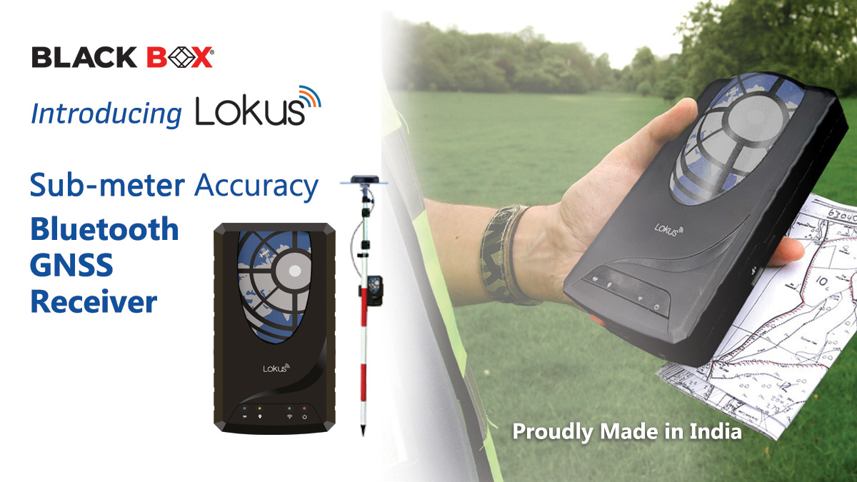
Indian Engineers now develops Lokus GNSS, which can convert all smart phones in to high precision survey instrument
No more spending millions of dollars in imported survey equipment’s. Indian Engineers now develops Lokus GNSS, which can convert all smart phones in to high precision survey instrument.
Read More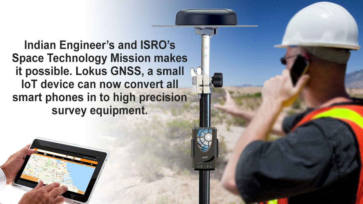
Every smart phone can now be a High Precision Survey Equipment through Lokus GNSS IoT device
Disruptive IoT solution by Indian Engineers changes the face of geospatial survey in India. Every smart phone can now be a High Precision Survey Equipment through Lokus GNSS IoT device developed in Bangalore.
Read More
Lokus GNSS, a small IoT device can now convert all smart phones in to high precision survey equipment
Indian Engineer’s and ISRO’s Space Technology Mission makes it possible. Lokus GNSS, a small IoT device can now convert all smart phones in to high precision survey equipment.
Read More